Amak Island
| Amak Island
| ||
|---|---|---|
 | ||
| Gewässer | Beringmeer | |
| Inselgruppe | Fox Islands | |
| Geographische Lage | 55° 25′ 2″ N, 163° 8′ 58″ W | |
| ||
| Fläche | 15 km² | |
| Höchste Erhebung | Mount Amak 488 m | |
| Einwohner | unbewohnt | |
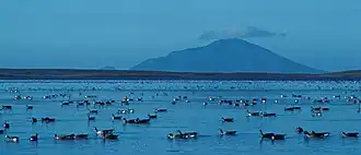 | ||
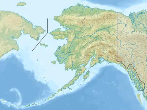
Amak Island ist die östlichste Insel der Aleuten und gehört zu den Fox Islands (Alaska). Die Inseln gehören zu Alaska (USA). Sie liegt nördlich der Westspitze der Alaska-Halbinsel und nordwestlich von Cold Bay.
Die Vulkaninsel mit einer Fläche von 15 km² erreicht eine Höhe von 488 m. Die höchste Erhebung ist der Schichtvulkan Mount Amak.
Weblinks
Commons: Amak Island – Sammlung von Bildern, Videos und Audiodateien
- Amak Island. In: Geographic Names Information System. United States Geological Survey, United States Department of the Interior (englisch).
- Amak Island im Global Volcanism Program der Smithsonian Institution (englisch)
- Beschreibung von Amak beim Alaska Volcano Observatory (englisch)